Topic Maps seminar in western Norway
HØYKOM, a Norwegian research funding agency, arranged a seminar about Topic Maps in Leikanger, a village in western Norway. To get there from Oslo you have to fly turboprop for 40 minutes to Sogndal airport, then drive for another 40 minutes out along the fjord. The place itself has maybe 1000 inhabitants, but is the location for norge.no (Norway.no; central Norwegian governmental web portal), which is why the seminar was held here.
Update 2006-03-14: The slides are now posted, so links have been added below.
Leikanger is remote, but the compensating benefit is that it is startlingly beautifully located by Sognefjorden, Norway's longest fjord.
|
Leikanger on the map | 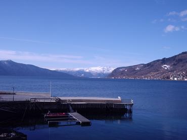
The view from Leikanger |
The first speakers
The organizers were expecting that attendance would be limited to norge.no and a couple of HØYKOM projects, and were quite surprised to find that 60 people registered and showed up. The result was that when I arrived at 0905 the room was packed, and only two chairs at the back were free. Thankfully one of them was next to a power outlet, so I could finish my slides.
The first speaker was Vemund Riiser, program coordinator at HØYKOM. His subject was "Why information management is important to HØYKOM" (slides). Unfortunately, I was busy writing my last slides during his presentation and so missed much of what he said. One quote of his was noteworthy, though: "Topic Maps is perhaps the most advanced activity we are involved in," and he went on to say that this was an area in which HØYKOM wanted to contribute to development of new knowledge.
The next speaker was Christer Gundersen of Kommunenes Sentralforbund (an umbrella organization for Norwegian county administrations), who spoke on "Topic Maps and semantic standardization in the public sector" (slides). He focused mostly on the need for common concepts and common information structures in the public sector, and the importance of semantic technologies in achieving this. He saw Topic Maps as a potential way to meet these challenges. Focus areas for KS was open standards (like Topic Maps) and open source. He used a cute personal anecdote involving his wife and a baby stroller purchase to explain the importance of open standards (wife wanted stroller from one manufacturer, but a top from another, and the two didn't fit because there are no standards for these things).
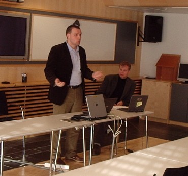
Christer Gundersen speaking | 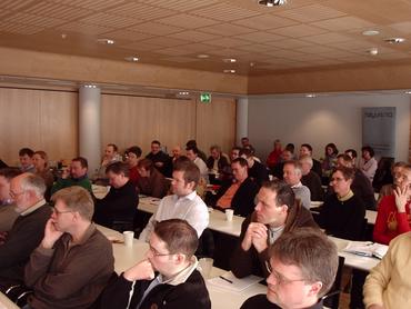
The audience |
LivsIT
Third speaker was Ove Nyland, director of Norge.no. His subject was LivsIT, which is a Norwegian taxonomy for the classification of public-sector information, primarily targeted at county administrations (slides). The project was initiated in 1996, and led up to one taxonomy published and used 2002 to 2005, but the project is now dead. Norge.no has seen that this project met a strong need in the public sector, even if the actual implementation was somewhat less than flawless. (The old structure, published in the form of a pretty shaky XTM file, but one actually containing PSIs, can be found on the old project site.) The new LivsIT will be less rigid and no longer based on the concept of life situations.
Nyland then handed over to Frank Fardal (also of Norge.no), who went into more of the detail of the new project. Norge.no is planning to establish a new taxonomy, a reference implementation, and interchange server taxonomy users can get updates from by July 1 2006. They asked for candidates for reference implementations, input on the general approach, and suggestions for a new name. (LivsIT was short for "life situations", but as that principle has been abandoned the name is no longer appropriate.) The working title was, "in proper bureaucratic spirit," "Public Service Information Structure," which sounds to me most like a threat to encourage better proposals.
Fardal made it clear that LivsIT was to be a technology-independent structure, and that it would probably be made available in different forms. He explicitly mentioned Topic Maps, web services, XML, and RSS as candidates under consideration. Personally, I think that as two of the first users will both be Topic Maps projects, it would be strange if no Topic Maps alternative were provided.
Last speakers before lunch
After this it was my turn, and my task was to explain what Topic Maps are, and how they can be used, all in 30 minutes. This is not an easy task, but luckily I managed to get 15 extra minutes from the organizers, which made it all much more doable. My goal was to introduce the concept and its applications, and to give a little glimpse of what the future might hold. I'd replaced the old TAO slides with a new set of shorter and more focused slides, and this was my first trial run of this new introduction (still strongly inspired by the old slides). It turned out to work very well, and I really enjoyed myself. There were lots of questions, and in the end we had to break for the next speaker.
The next speaker was Jørund Leknes, a politician from SV, a Norwegian leftist party (the name means Socialist Leftist Party). SV is now in government for the first time ever, and Leknes's presentation was an interesting example of how the Norwegian left has really caught on to and embraced the ideas behind open source and open standards. Leknes towards the end really emphasized a commitment to open standards as a way to prevent monopolies and vendor lock-in (clearly issues with some appeal to the far left). He seemed especially concerned about proprietary data formats, and used a phone analogy to explain the importance of standards. He even presented a list of concrete efforts, which looked reasonable, but sadly lacked any mention of actually contributing to the standards processes. (I asked him about this in the Q&A, but beyond saying that he was aware of the problem he didn't really have anything concrete to offer.)
HØYKOM project presentations
The first post-lunch speaker was Hans Henrik Thune of Invida, presenting a Topic Maps project done by a group of three Norwegian counties in Numedal (a region in southern Norway) (slides). (Full disclosure: I was involved in this project for a while.) He started out with the background of the project, which was a common service portal established by the counties over from 1999 to the present. The portal currently has services provided by the counties classified using LivsIT, but information about the services only appears in the form of links to other sites.
The goal of the project was to prototype a better approach where the processes required by the user to make use of the actual services are described using Topic Maps. The services are still classified using LivsIT, but once the service is found you get a process map in the form of a topic map. Hans Henrik showed the actual ontology, and some mockup screens showing how the solution might be implemented. The next challenge for the project is to do the integration between the central server and the actual service providers.
The next speaker was Jan Werner Bjørklund of IKT Follo. Follo is another Norwegian region (rather larger than Numedal), consisting of six counties with altogether 110,000 inhabitants. (This is actually the neighbouring region to where I grew up.) They are working on a service portal rather like Numedal, and they are also doing process modelling, but their focus is internal rather than external. They also want to use Topic Maps, but are only starting that part of the activity now.
After this we had Jarle Tvinnereim of the local county administration talking about IT Forum Sogn og Fjordane (local conference in same region as Leikanger), and a broadband project funded by HØYKOM. My phone rang during this presentation, so I missed most of it, but as far as I could tell there was very little of Topic Maps relevance here. (Slides)
The Cerpus boys
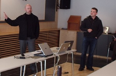
Tommy and Jarle |
The last speakers of the day were the two Cerpusians: Jarle Meløy and Tommy Nordeng, who amidst much laughter and jokes went through a catalogue of what they've done with Topic Maps, and their concerns for the future (slides). They started with the decision by the government to express the Norwegian national curriculum in Topic Maps, where the plan is for the material to be ready for the 2006-2007 school year. Cerpus (and various allies) have been working hard behind the scenes, and now it's finally happening.
Next, inevitably, was BrainBank, where we were treated to their standard demo video, which showed the interface, and, gratifyingly, the Vizigator. They also emphasized the pedagogical thinking behind the tool, which is that merely having information available doesn't mean the students acquire knowledge. For that the students need to actually work with the information and digest it, and this is what BrainBank helps them do.
Their next project is to integrate the open source LMS Moodle with BrainBank, so that BrainBank topic maps can appear as one of many kinds of resources within the LMS. (A side benefit, Tommy told me last night, is that BrainBank can get out of all the user/school/course management that it has to do today, and instead just focus on the conceptual learning.)
Wrap-up
That was the entire seminar. Like the organizers I was surprised to see how many people turned up, and the extent of the interest in Topic Maps. It'll be interesting to see how many people show up for Emnekart 2006, and for the events that Ontopia arranges before and after.
Similar posts
Emnekart 2006
This was the fourth Norwegian Topic Maps conference (emnekart is Norwegian for Topic Maps), and for the first time it was not entirely in Norwegian, as this year there was an English track through the whole conference
Read | 2006-03-30 20:59
TMRA'05 — second day
(Second day of semi-live coverage from the TMRA'05 Topic Maps research workshop.)
Today we again start with Jack Park, this time speaking on "Just for Me: Topic Maps and Ontologies"
Read | 2005-10-07 13:33
Impressions from Strata London 2013
The first thing that struck me about the conference was that it had to be a fairly new conference
Read | 2013-11-20 08:44
Comments
Svein Ølnes - 2006-03-12 17:46:41
Very nice summing up, Lars Marius. However, you are doing Leikanger a bit unjustice with regard to it's size. It is a small place but the number of people living there is a bit higher than you indicated - 2 199 at 01.01.2006 to be exact.
Another reason for letting Leikanger and the County Governor of Sogn og Fjordane host the seminar was to give credit to the work the County Governor Oddvar Flćte has been doing in Hřykoms board for serveral years.
Lars Marius - 2006-03-13 10:09:48
I freely admit having done the estimate of the number of inhabitants based on how large Leikanger looks from the road. :-)
Anyway, thanks for adding a bit of background.
aditya - 2010-12-01 19:59:48
Slides must be in english pls.